Your World.
One Hex at a Time.
Create and manage your worlds with unparalleled freedom
CartoHex is an upcoming project that we are actively working on and are hoping to release an alpha version to test users soon. If you ar interested in this project and would like to help us make it into something great, stay in touch
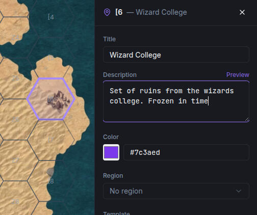
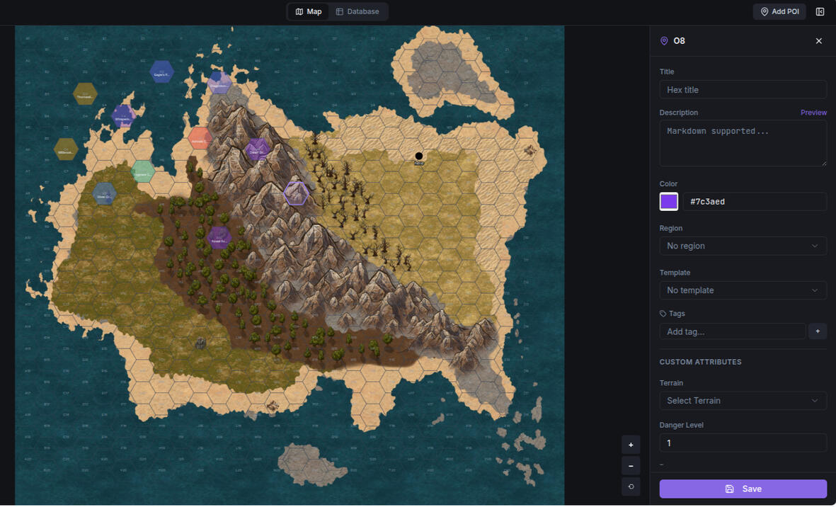
Edit Every Hex
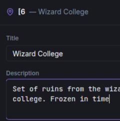
With CartoHex, every hex is a unique location and can be fully edited and maintained without the need for multiple spreadsheets, microsites, or wiki'sWith custom tags and attributes, multiple data views, region grouping, and and dynamic overlays, designing and maintaining a large dynamic wilderness campaign has never been easier
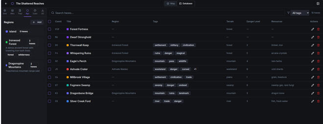
Database View
Organize your hexes with custom tagging and attributes for easy lookup and reference. Sort, filter, and update entire regions as a group or just a single hex
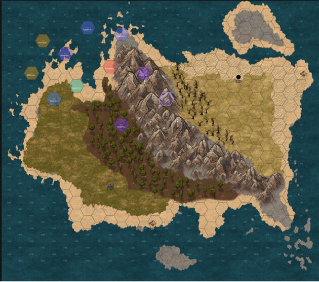
Use Your Map
CartoHex helps manage your hexes. Upload an image of a map and scale the hexgrid freely
Custom Templates
Reproduce hexes quickly and automate your workflow with customer templates
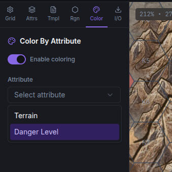
Dynamic Shading and Highlights
Quickly visualize faction politics, threat levels, or even terrain elevation with dyanmic recoloring and shading layers
CartoHex
If this seems like a project you would interested in joining, sign up for free below to be part of our test audience when we go to pre-alpha in a few weeks
Updates
3/13/2026 - Launched to First Test Audience
3/14/2026 - Started Discord Server
3/14/2026 - Resolved Multiple Bugs (map scolling, user profiles, multiselect functionality)
© Untitled. All rights reserved.